-
Solution
How it works Gemminis
From data collection to intelligent reporting: a complete solution to manage your assets efficiently.

The technology behind Gemminis
Georeferenced capture, artificial intelligence processing and structured data delivery for advanced analysis and visualization in professional environments.
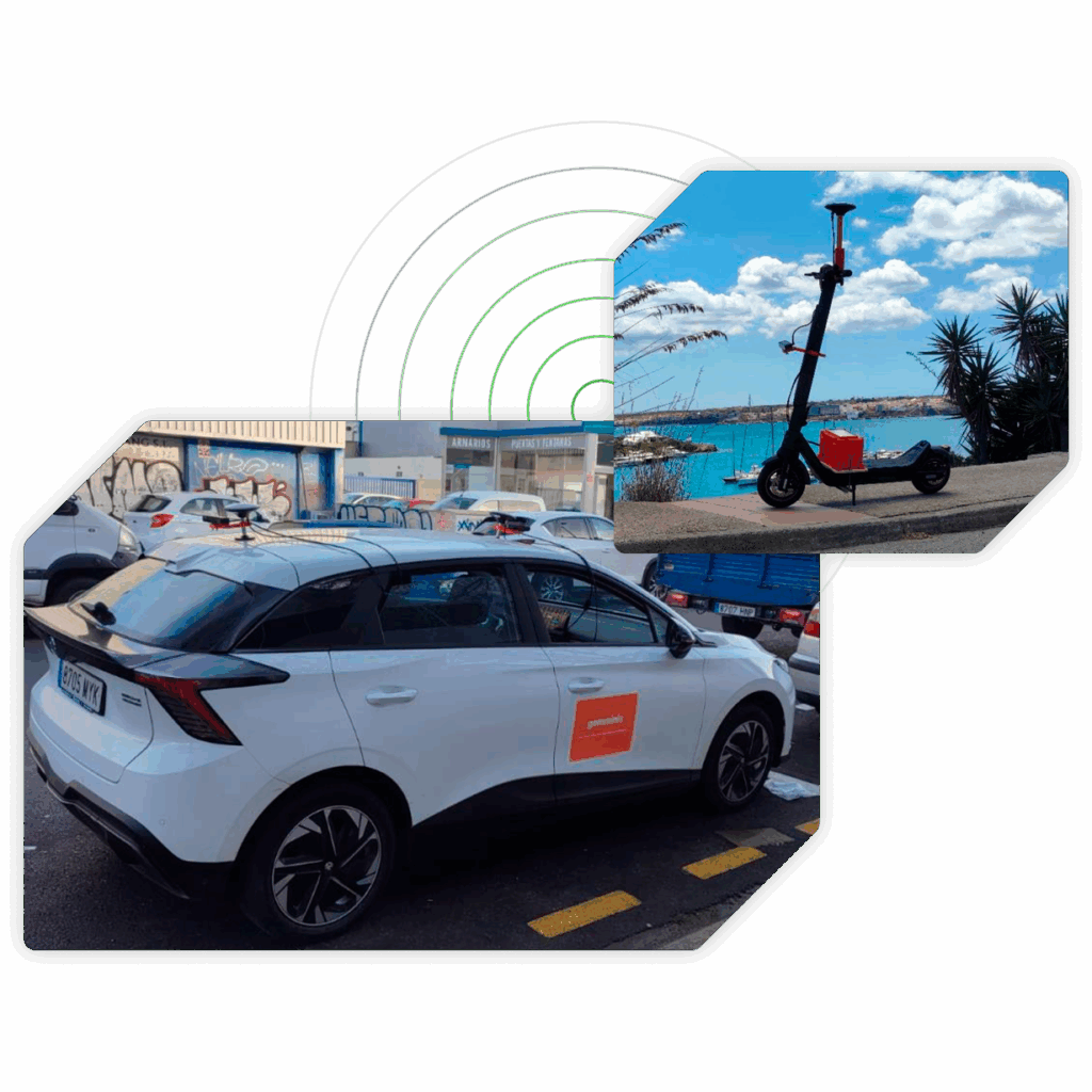
Georeferenced capture
We perform data collection in the field using high resolution cameras and specific sensors. Each image is geolocalized, segmented and assigned precise coordinates for further analysis.
-
Bifocal camera
-
High precision GPS system
-
Inertial system
-
Integrated CPU
-
Remote connection via Internet
-
100% electric vehicles
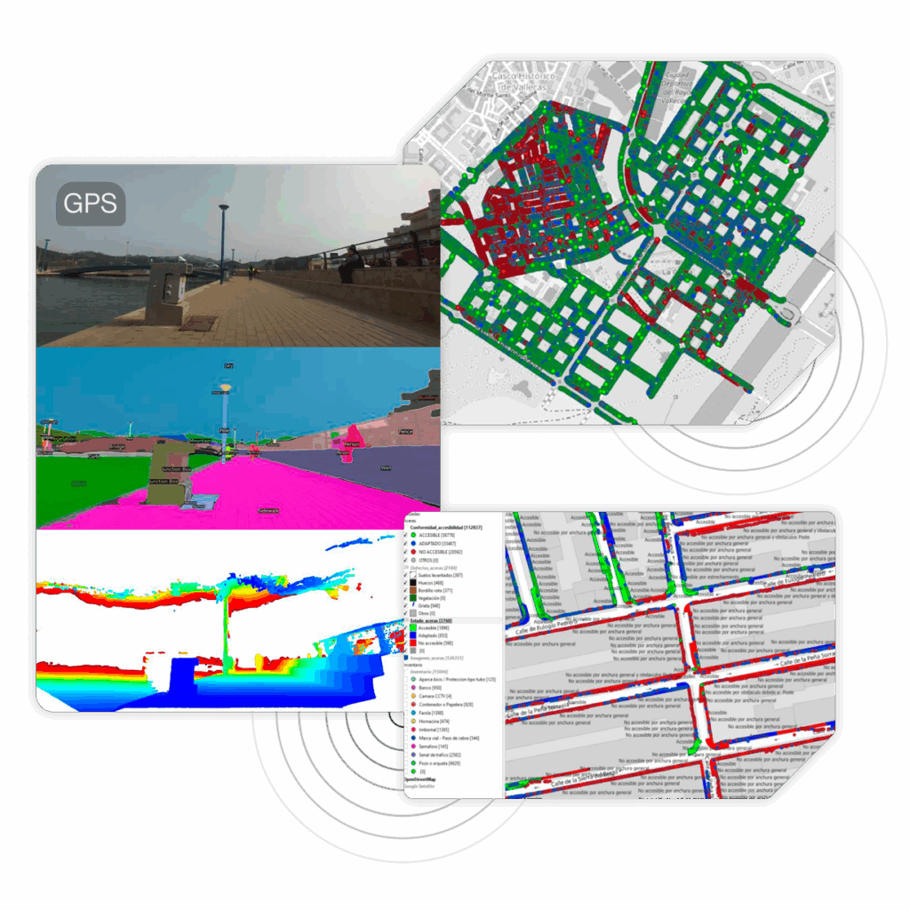
AI processing and visualization
The extracted data are processed by computer vision and artificial intelligence algorithms. Subsequently, they are integrated into databases PostgreSQL y PostGISdatabases, ready for their technical visualization and validation in QGIS.
-
Geolocalized image
-
Segmentation
-
Coordinates
-
Database
-
Inventory modules
-
Data visualization
-
Validation
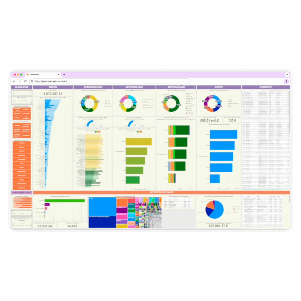
Data management
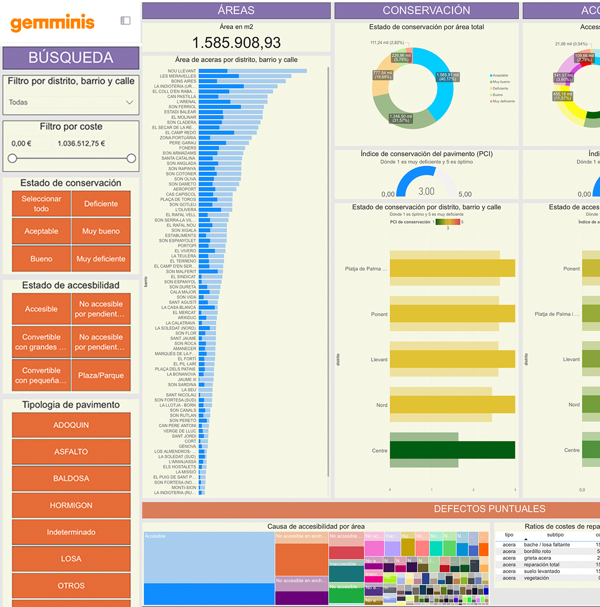
All the processed information is transformed into an interactive dashboard developed with Power BI. From there, the client can visualize, analyze and make informed decisions in a clear, intuitive and dynamic way.
-
Interactive display
-
Obtaining metrics
-
Dynamic filters
-
Dasboard with graphics
-
Customizable panels
-
Decision making
Converts urban space into optimized data
Our infrastructure combines artificial intelligence, high-precision sensors and a powerful inventory module to provide you with structured, useful and directly manageable data.
High precision sensors
Cameras and vehicle-mounted equipment for accurate capture of the environment and assets.
Artificial intelligence
Algorithms trained to detect defects and inventory automatically and generate useful data.
Geolocation-GIS integration
Data compatible with existing municipal and private management systems on the market.
Analysis with PowerBI
Interactive Dasboard for decision making, visualization and data management.
Upgraded system
Dynamic inventory and global technology that is constantly updated and growing.
Inventory module
Urban inventory that automatically detects and classifies hundreds of land elements.
Beyond the data
We differentiate ourselves from our competitors
Gemminis
Competition
Specialization in sidewalks
Focus on sidewalks and accessibility.
Accurate geolocation
Data with exact location.
–
Status indices generated
Calculation of the statement of assets.
–
Integration with PowerBI
Interactive visual management panels.
Customized solutions
Adaptation of the solution to the client.
Delivery in decision format
Data ready for action.
–
Delivery speed
Results in less time.
More competitive price
Complete solution at lower cost.
We don't just tell you what's out there.
We help you decide what to do with it.
Contact us and we will show you how to transform your urban data into clear decisions.

